Seljord
Lifjell


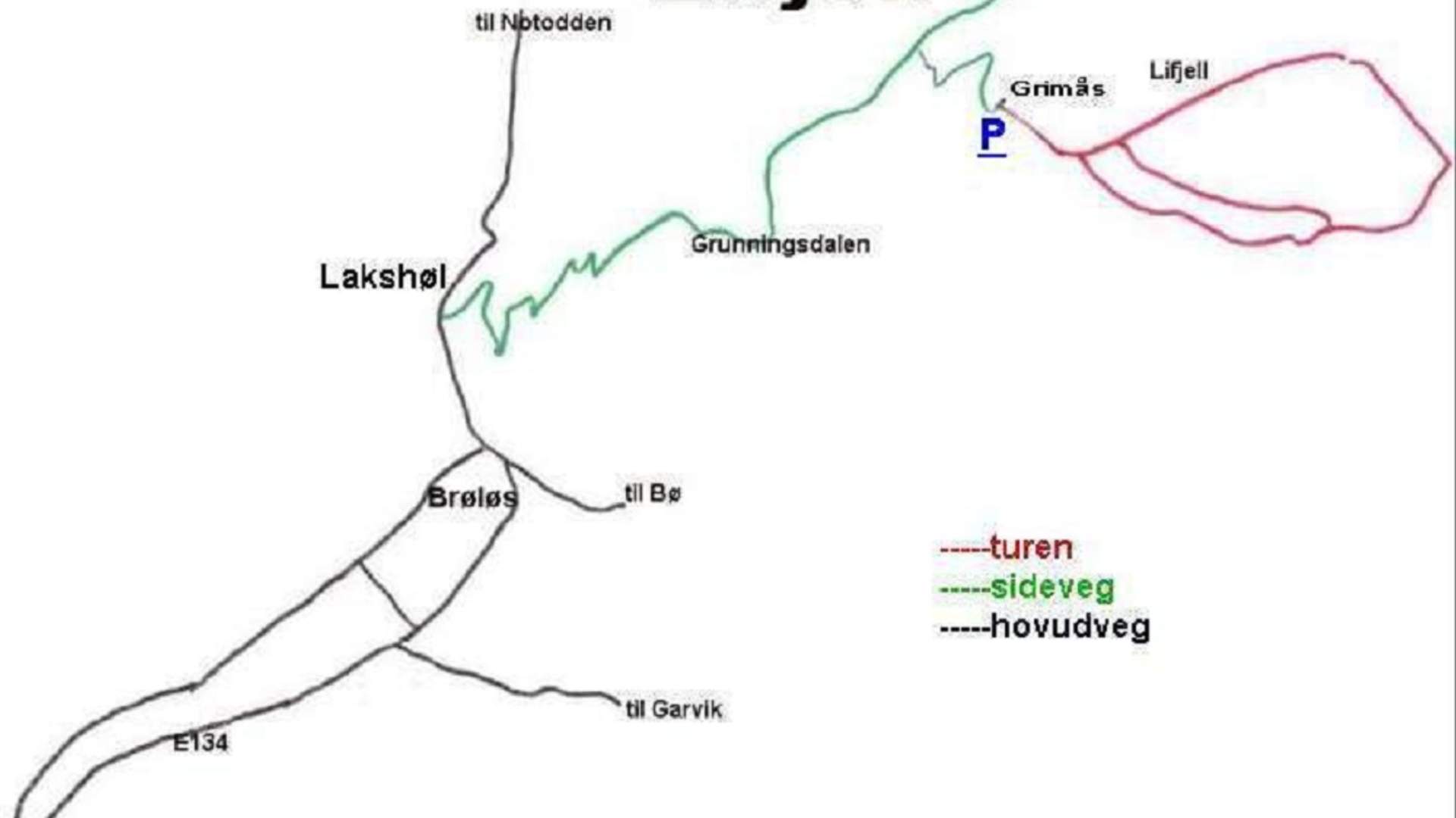
Driving Distance Brøløs - Lakshøl: 2.9 km. Lakshøl-Grimås: 8 km
Toll: 35 kr
Walking time: Grimås-Tvitjønnan-Gråntjønn-Grimås: about 2.5 hours
Level: Medium
Lifjell is the mountainous plateau between Seljord, Bø, and Notodden Hjartdal. A likely starting point for mountain walks Lifjell can be to start at Grimås. In the direction of Notodden drive up to Grunningsdalsvegen Grimås, where there is a large parking lot. The climb through birch woods on marked trail is steep. After a while you come to a path where you can choose between two routes that are signposted to:
a) Tvitjønnan - Tjorbu
b) Bekkjestaul - Tjorbu
Take the path up to the left where the terrain gradually opens up to the two idyllic lakes, Tvitjønnan (two pond) 999 m and 998 m above sea level. Then walk the path diagonally up the hillside to the left until Gråntjønn 1048 meters above sea level. From here: open, easy terrain. The marked trail returns via Bekkjestaul to Grimås.
Alternative route: Grimås - Tvitjønnan - Tjorbu - Røys Dalane: about 3 hours from the trail along the creek Tjorbu through Røys dalane via Grimaren to Grimås is partly poorly marked.
From Tjorbu there are many fine hiking routes in different directions at Lifjell.
Quelle: Vest Telemark
Lifjell